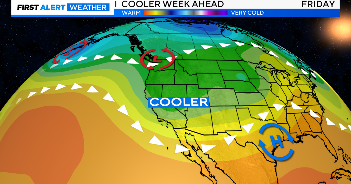
Searing Stretch Of Triple Digit Heat Ahead
A ridge of high pressure has brought an abrupt end to the cool, wet weather that kicked off the work week.
High temperatures Thursday afternoon will soar to about 95 to 97 degrees in the valley, with sunshine and low-to-mid 90s in the foothills.
Mild overnight lows in the mid 60s will pave the way for 100-degree heat by Friday afternoon. We'll see a few thunderstorms rumble across the Sierra at that time, but the rest of northern California will remain sunny.
The mercury creeps even higher on Saturday and Sunday, with weekend highs between 100 and 105 degrees. That's 10 to 15 degrees above the normal high of 90 for this time of year. However, it is just below record high temperatures for Sacramento, which are between 107 and 112 degrees for the final days of June.
We'll be sweating out the hottest days in this stretch on Monday and Tuesday, with temperatures highs between 100 and 105 degrees. The record high at Sacramento Executive Airport for Monday is 109, which was set in 1950. For Tuesday the record high is 109, which was set in 1991.
In all, it looks like we're going to see six consecutive days of triple digit temperatures before we -- hopefully -- drop back down into the upper 90s next Thursday.
The National Weather Service in Sacramento issued an excessive heat watch, which is in effect from Sunday through Wednesday afternoon.