First Wave Of Storm System To Arrive In Sacramento Area Tuesday Afternoon
There's a storm moving into northern California that's expected to be over Sacramento just before 3 p.m. Tuesday. Here's what you can expect.
Late tonight and early tomorrow, we'll see an increase in winds. It won't get very windy in the Sacramento area, but in the mountains, we could see gusts topping 55-60 mph.
Around Tuesday at noon, we'll see signs the storm is on its way. The winds will pick up ahead of it.
TIMING
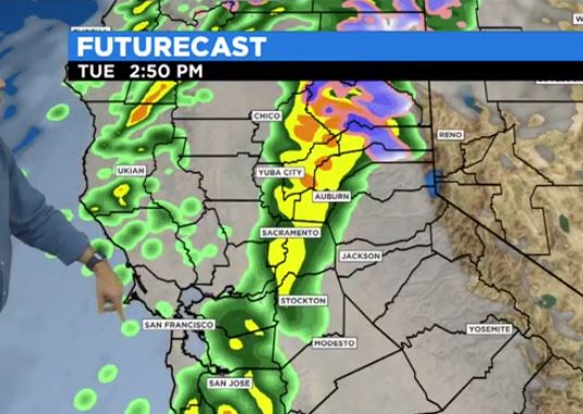
At 9 a.m., we'll see the storm moving into the western part of the valley. It will move into our area around 2:50 p.m. There will be periods of heavy rain. It will be the first time the LNU Complex Fire has seen significant amounts of rain.
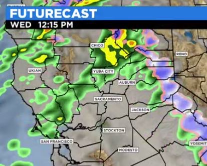
A second wave of the storm will reach the west coast early on Wednesday.
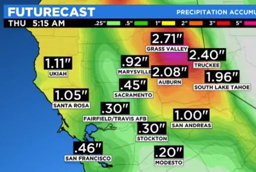
By the time the storm moves out, we could see up to a half-inch of rain in Sacramento -- maybe up to an inch in Marysville.
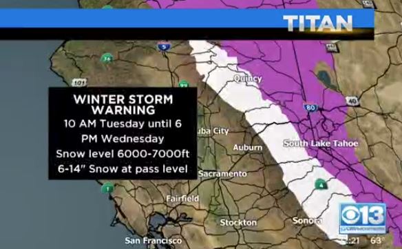
The storm system will bring a lot of snow to the mountains. A winter storm warning is in effect from 10 a.m. Tuesday to 6 p.m. Wednesday.
There will be snow at the 6,000-7,000-foot level, with as much as 14 inches at the pass level.
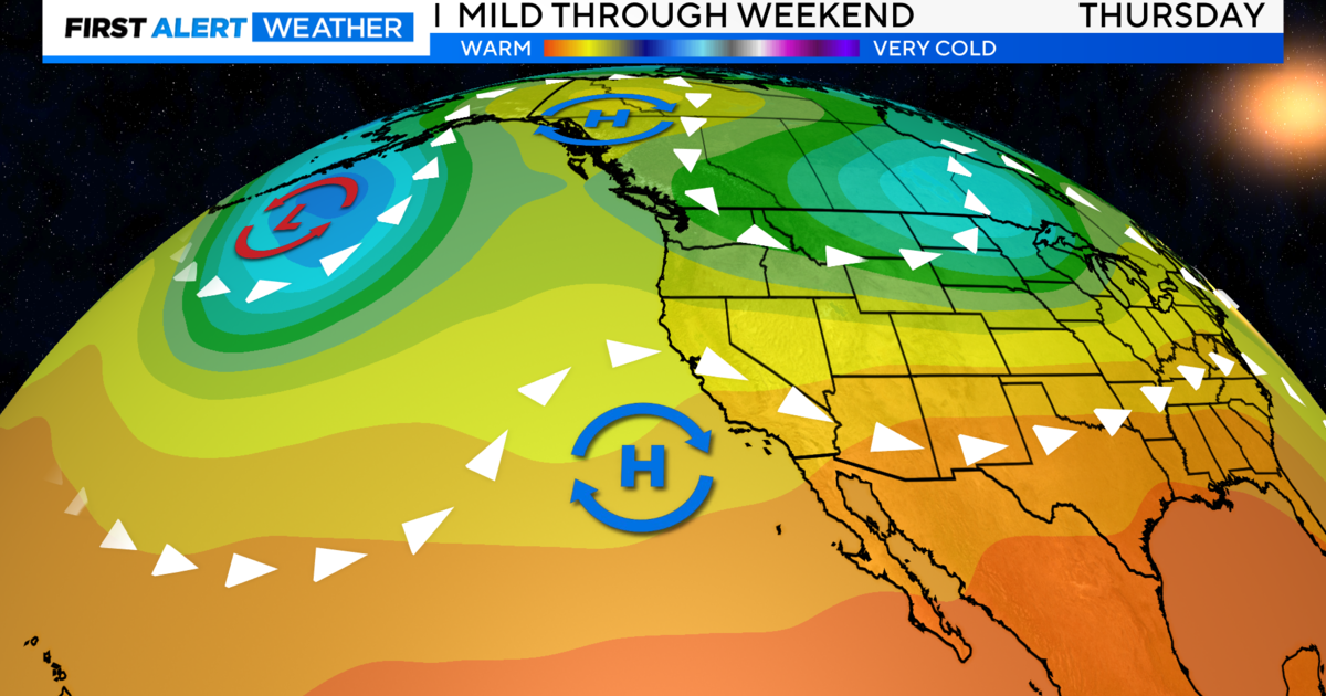
Temperatures are milder than normal Monday as we top out around 70 degrees.
7-DAY FORECAST
- MONDAY: Partly cloudy, a high of 70, and a low of 50.
- TUESDAY: 80% chance of rain with a high of 64, and a low of 55.
- WEDNESDAY: 50% chance of rain, a high of 63, and a low of 46.
- THURSDAY: Cloudy with a high of 62, and a low of 42.
- FRIDAY: Partly cloudy with a high of 61 and a low of 36.
- SATURDAY: Partly cloudy with a high of 62, and a low of 36.
- SUNDAY: Partly cloudy with a high of 61, and a low of 38.
Stay in the know, visit the CBS13 Weather page and download the CBS13 Weather App.