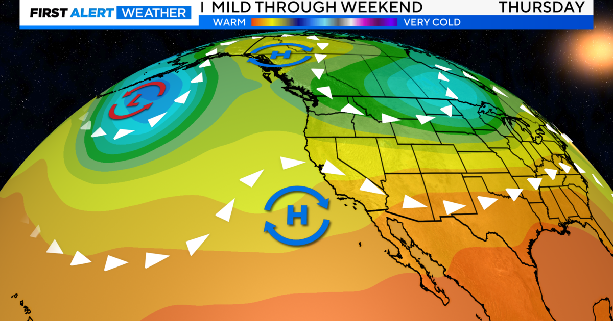
Cooler Temperatures Continue; Warm Slightly Next Week
Cooler temperatures will continue, with slightly warmer temperatures returning early next week. Scattered showers and thunderstorms are possible this weekend, mainly over the mountains, though a few storms may migrate into the lower elevations late this afternoon and this evening.
Tonight, the focus will be on the low-pressure area that is currently over Northern San Joaquin valley and where showers and thunderstorms develop.
As the low moves south this evening, wrap-around moisture will be carrying any activity westward towards the valley. The best chances for any activity within the valley remain north of Sacramento.
Thunderstorms will be capable of brief heavy rain, small hail, and gusty winds.
As the low moves southward into the Southern San Joaquin Valley late tonight, chances of showers moving into the valley will increase over the Northern San Joaquin valley while decreasing further north.
Winds through the Delta will continue to be breezy overnight but expecting a lower marine layer so chances of low clouds are not as great as this morning. That said, we may see some into the Delta and perhaps the eastern side of the valley, and foothills form by morning.
SUNDAY
By Sunday afternoon, the low will be centered near Las Vegas with wrap-around moisture continuing.
The activity could reach the foothills but not the valley. Warmer temperatures are expected over the northern valley with slightly cooler temperatures over the southern areas. As the low moves east Sunday night, activity will diminish. The Delta breeze looks to be stronger and we should have a slightly higher marine layer than tonight so low clouds will have a better chance of advecting into the Sacramento region by Monday morning.
MONDAY & TUESDAY
Monday will be dry other than a chance for some afternoon pop-up
showers and thunderstorms near the crest from near I-80 southward.
Temperatures will be warmer for most areas with slight cooling over the north end of the valley and surrounding mountains. Weak ridging on Tuesday will keep the area dry with some warming of temperatures.
WEDNESDAY-SUNDAY
There are no major changes to the extended forecast as confidence remains high in a cooler weather pattern for NorCal. Maximum temperatures are forecast to run some 5 to 15 degrees below normal during the period, while minimum temps look to be about 2 to 10 degrees below normal.
Thursday is still looking to be the coolest day out of this period with highs generally in the 70s for the Valley, the 60s for the foothills, and 40s and 50s for the mountains.
In addition to the cooler weather, models and ensembles are hinting at renewed chances for showers. The showery regime is especially favored over the higher terrain due to topographic lift and forcing. Snow showers may occur over the higher elevations, above 5000 or 6000 feet, of the Sierra as well, mostly likely Thu/Fri.