King Fire Grows To 89,574 Acres; 35 Percent Contained
EL DORADO COUNTY (CBS/AP) — Crews have nearly doubled containment of a wildfire threatening thousands of homes in Northern California, as they brace for dry heat and erratic winds that could undo their progress.
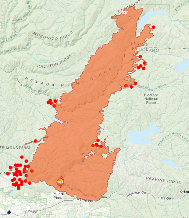
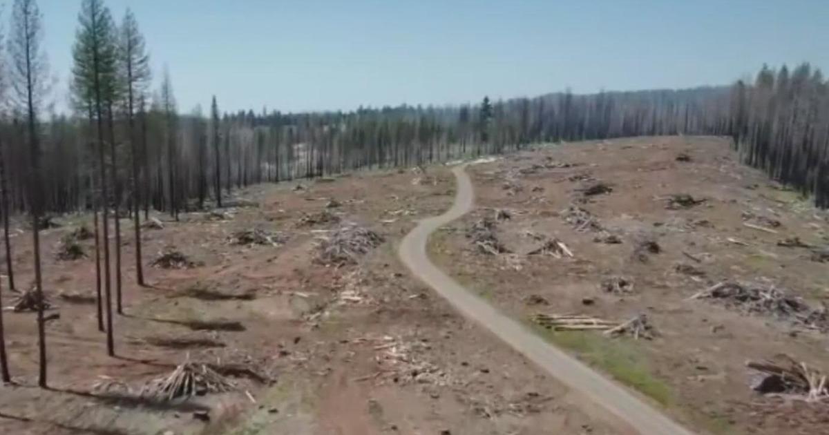
The fire east of Sacramento was 35 percent contained Tuesday, up from 18 percent a day earlier. The fire has burned through nearly 140 square miles, or 89,574 acres, but it showed little growth overnight.
Fire spokesman Ryan Lubben says crews are focusing on expanding containment lines ahead of a red flag warning in the afternoon, when wind gusts of up to 35 mph are expected. That coupled with low humidity could stoke the flames and send embers flying ahead of the blaze.
The fire is threatening 12,000 homes and has forced about 2,800 people to evacuate.
Click here to visit Cal Fire's incident web page.
The Red Cross continues to provide affected residents with overnight shelter and other services at the Camino Seventh Day Adventist Church, 3520 Carson Road in Camino, according to a statement from the El Dorado County Sherriff's Office. It also opened a service center at the Church of Our Saviour, 2979 Coloma Street in Placerville and will have case workers and bulk distribution supplies at this location between 10 a.m.-6 p.m. Tuesday. This location is not an overnight shelter site.
Classes have been canceled for all schools within Black Oak Mine Unified School District in El Dorado County.
Coming winds and warmer temperatures brought worries that progress made in slowing the growth of a massive wildfire in Northern California could be undone.
On the heels of cooler, wetter conditions around the King Fire east of Sacramento that has burned 137 square miles and destroyed 10 homes, Tuesday is expected to bring winds up to 30 mph and low humidity that could bring a new surge.
"This could set up some potential fire growth similar to what we experienced when it grew exponentially last week," said state fire spokesman Capt. Tom Piranio. "We are working very aggressively to maintain the contingency lines."
A red flag warning of very high fire danger has been issued Tuesday and Wednesday and could bring even greater gusts.
"It's definitely going to pose a challenge to the control lines the firefighters have created," said Holly Osbourne, a National Weather Service meteorologist in Sacramento. She said Thursday will bring a slight chance for rain.
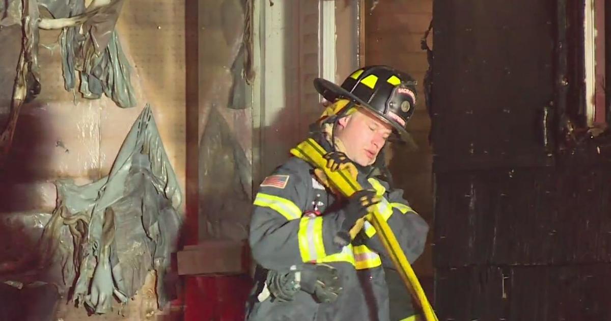
On Monday, more than 5,000 firefighters — from as far as Florida and Alaska — scrambled to extend control lines in expectation of tougher conditions. The blaze was just 18 percent contained nearly 10 days after it started.
It threatens about 21,000 structures, more than half of them homes. It has destroyed 10 houses and 22 minor buildings in the White Meadows area of Pollock Pines.
About 2,700 people remain under evacuation orders, said state fire spokesman Daniel Berlant. The fire also continued to threaten a key University of California, Berkeley, research station that is home to scores of experiments on trees, plants and other wildlife.
The blaze was spreading smoke beyond California, with the weather service issuing a "dense smoke advisory" about 100 miles away in Reno and Lake Tahoe on Monday. Shifting winds later pushed the worst of the smoke back west.
Those winds sent the air quality index into the "very unhealthy" level for general populations in Auburn northeast of Sacramento — where some schools closed, as well as the Roseville and Rockville areas.
A man charged with starting the fire, Wayne Allen Huntsman, 37, pleaded not guilty to arson Friday. He remains in the El Dorado County jail on $10 million bail.
As of 11 a.m. Monday, the following areas are under mandatory evacuation orders, according to the El Dorado County Sheriff's Office:
Forebay Area
Forebay Road (north of Moon Lane), Homestead
Mosquito, Swansboro Area
Mosquito Road - north of the American River, Rock Creek Road - east of Rock Creek, Mosquito Cutoff Road, Adams Lane, Amber Way, Buckboard Road, Buckeye Court, Cable View Court, Cedar Court, Claim Court, Claim Lane, Claim Street, Claim Terrace, Corder Court, Darr Court, Deer Canyon Court, Deer Park Drive, Dickinson Road, Dogwood Lane, Dyer Court, Dyer Way, Gold Court, Gold Trail, Gold Rock Road, Gravel Court, Gravel Road, Highgrade Street, Holiday Lane, Immerville Drive, Indian Way, Junco Court, La Paz Road, Lawyer Drive, Log Cabin Court, Log Cabin Lane, Long Gulch Court, Lupine Court, Lupine Lane, Maidu Drive, McGuire Court, Morton Court, Normas Road, Orval Beckett Court, Pawdick Court, Peycos Drive, Pine Cone Court, Pine Needle Lane, Poke Court, Ponderosa Grove Drive, Rex Court, Riffle Court,Running Quail Court, Shale Drive, Shilo Drive, Slab Creek Court, Sluice Street, Stope Court, Stope Drive, Story Lane, Swansboro Road, Trail Gulch Road, Triple R Road, Tumeli Lane, Webb Fork Road, Wildflower Court, White Oak Drive, Yankee John Court, 1 Eye Creek Court, 1 Eye Creek Road
Volcanoville, Quintette, Blodgett, Upper Ice House Area
Bear Foot Road, Bear State Road, Bird Nest Lane, Blodgett Forest Road, Bojac Court, Bootjack Mine Road, Carey Ave, Cassill Mine Road, Cecil Lane, Cedar Cable Road, Chiquita Bypass, Christmas Tree Lane, Country Road, Ditch Camp Road, Dry Lakes Trail, Dusty Camp Road, East Carey Avenue, El Bosque, Garden Tower Lane, Harmony Lane, Haven Ridge Road, Helix Flat Avenue, Horse Power Drive, Kentucky Flat Road, Little Silver Road, Lodgepole Lane, Lofty Peak Lane, Logging Road, Loop Cutoff Road, Loop Road, Merkel Drive, Middle Loop Road, Midway Loop Road, Narrow Way, Onion Valley Road, Otter Creek Road, Paymaster Mine Road, Peavine Point Road, Piolet Creek Road, Plum Creek Road, Point Lane, Quintette Court, Ringtail Place, Ringtail Road, Robs Cabin Trail, Rock Creek Road (one mile south from Wentworth Springs), Rubicon Road, Sand Mountain Boulevard, Shotgun Lane, Sleigh Bell, Snowy Way, South Creek Road, South Fork Trail, Spring Tunnel Mine Road, Star Lane Thumper Lane, Stickerbrush Trail, Sunset Peak Lane, Tall Timber Road, Tinsel Trail, Tricometric Trail, Trinity Trail, Tunnel Hill Loop Road, Tunnel Hill Loop, Tunnel HIll Road, Un Road, Volcanoville Road, Wentworth Springs Road (east of Balderston Road), West Carey Court, White Fir Road, Winter Springs, Wild Horse Trail, Woodpecker Road, Yuletide Way, 11 Pines Road, 12 Mile Court, 12 Mile Road
Crystal Basin, Icehouse, Upper Wentworth Springs Area
Big Hill Lookout Road, Big Hill Road, Blodgett Forest Road, Bridle Path Way, Forest Road, Frontier Road, Granite Springs, Helix Flat Ave, Ice House Road, Jones Fork Power House Road, Middle Loop Road, Mosquito Road, Onion Valley Road, Outer Limits Lane, Little Silver Road, Loop Road, Peavine Point Road, Peavine Ridge Road (except for the 1st mile North of White Meadows Road), Pickett Pen Road, Piolet Creek Road, Plum Creek Road, Robb's Peak Road, Rubicon Trail, Sand Mountain Road, SMUDEA, Spring Road, Sunset Drive, Tricometric Trail, Wentworth Springs (east of Balderston Road), Windmiller Trail, Wrights Lake Road,11 Pines Road.
Including all Forest Service roads, trails, and access roads in the Crystal Basin recreation area between Ice House Road and Desolation Wilderness, north of the Highway 50 corridor.
Related articles